Hotspots by Waindigo [Deleted]

Can you setup multiple maps under the same Hotspots tab? One for Travel, one for Dining, etc.? Maybe different tabs where the Hotspots Map and Hotspots List are?
You will need separate tabs, or you will need to use Nodes As Tabs to set up a Category node as the tab and put multiple hotspot nodes in that category.

Also, What do the icon url and shadow url's do?
It allows you to specify the image for the marker and also for its shadow (optional).
 
You will need separate tabs, or you will need to use Nodes As Tabs to set up a Category node as the tab and put multiple hotspot nodes in that category.
Didn't even know you could setup a map as a node. That's helpful.

Would it be possible down the road to be able to have multiple tabbed maps under the main map tap?
 
You will need separate tabs, or you will need to use Nodes As Tabs to set up a Category node as the tab and put multiple hotspot nodes in that category.[/quote]

If you go with the Nodes As Tabs option, how do you keep the main nav tab from showing so you don't end up with 2 different maps links?

It allows you to specify the image for the marker and also for its shadow (optional).
Is there a default icon that we can link to or do we need a source for images? What if you just want the default Google pointer looking thingy?
 
Last edited:
Jon, there are a few little bugs in this version compared to the version that I paid to get developed including the entire top search bar is missing:
3.webp
But I note that others are requesting the search be incorporated into the default XF search so a user can search for a specific hot spot...something that I recall asking for in the original version and was going to pay extra for but you declined to do it.

The new option of scroll wheel doesn't work no matter what I set it at, in the original version the scroll wheel wasn't activated at all making it more user friendly...the address field is a nice addition although as you noted in the thread the Lat/Lng was used for accuracy and addresses are only possible in suburbia whereas in my situation with Airfields, country airfields don't have addresses and I suppose many hotspots that some users may have are outside of physical addresses in suburbia...anyway for others that is the reason why Lat/Lng was used. Another thing is the balloon on a spot doesn't display all the info and is set at a smaller size than what I have in the original version in displaying more info about the hotspot.

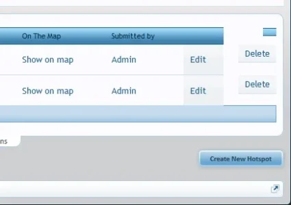
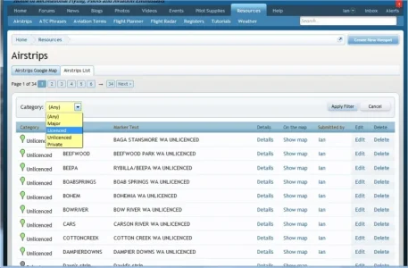
There is also an issue with the display of the list but I gather I will have to fix that with the css:
1.webp
 
Great addon Waindigo, thanks! (y)

I have one question: i imported a map with ~450 hotspots and everything is working fine - but the zoom value is too small for me. Is there an easy way to edit the zoom value for all existing (and new) hotspots instead of editing every single hotspot and save the new zoom value?

Thanks :)
 
Would it be possible to add in a permission to turn on/off visibility of the node on a per user group basis?
This permission already exists in core XenForo. You can turn on/off the 'View' permission right at the top of the list of permissions, or you can make the node private.
 
This permission already exists in core XenForo. You can turn on/off the 'View' permission right at the top of the list of permissions, or you can make the node private.
Ok, maybe I'm missing something, but I have it set not to view and the node is still visible. I forgot about the private node feature though.
 
How difficult would it be Jon to tweak the permissions to add an option so that changes to hotspots (create or edit) in map nodes by certain user groups go into the moderation queue?
 
@Waindigo - do you think this could be expanded / adjusted to take a GPX file rather than a single lat/lng reference? http://xenforo.com/community/threads/gpx-files-and-google-maps.54645/#post-582966

@Waindigo Any interest in extending this Add-On to include the above functionality, allowing users to import - or enter - multiple locations to plot a route? This way you could have users import/plot their favourite routes - boating, driving, bushwaking, bicycling, geocaching, etc. - allowing users to comment and rate the route, and add routes to a favourites list. I'm also thinking a GPX export option so they can download the route to their GPS devices. Functionality like this opens the add-on to even more usages and flexibility.

I'd be happy to contribute to the additional requirements, perhaps you would be too @MattW ? Anyone else interested in seeing this extended to allow routes, and willing to contribute?
 
How difficult would it be Jon to tweak the permissions to add an option so that changes to hotspots (create or edit) in map nodes by certain user groups go into the moderation queue?
Not too difficult. Drop me a PM.

@Waindigo Any interest in extending this Add-On to include the above functionality, allowing users to import - or enter - multiple locations to plot a route?
More than happy to do this if enough people can contribute. If you want to start a conversation and invite any interested parties then I will look into it and try and come up with an estimate of cost.
 
More than happy to do this if enough people can contribute. If you want to start a conversation and invite any interested parties then I will look into it and try and come up with an estimate of cost.
Done. If anyone else is interested, then feel free to give a shout-out to be added.
 
Top Bottom